Ferney trail, Mauritius

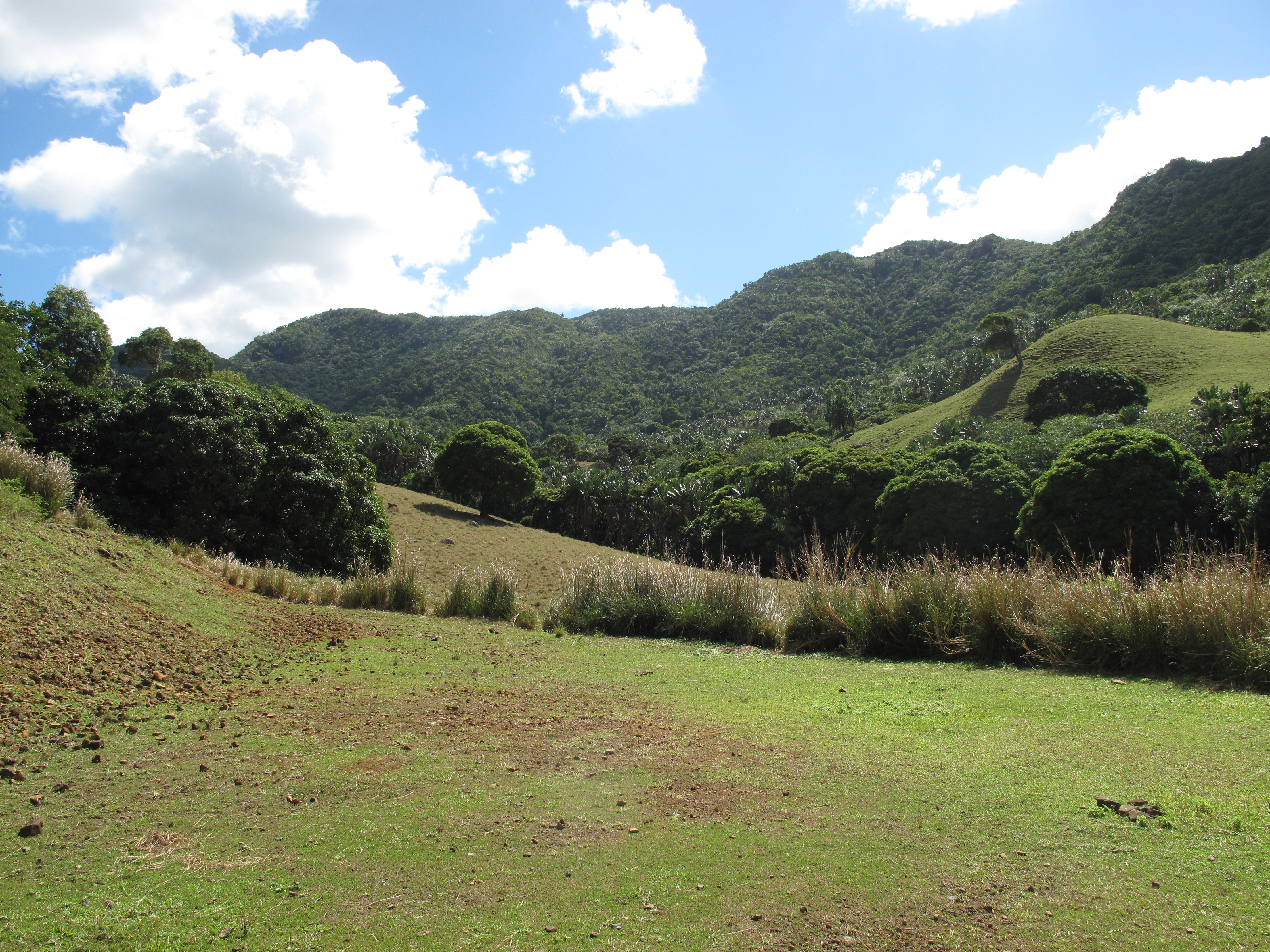
I woke before dawn to the sound of chirping crickets and light rain pattering on the roof of the Mauritian Wildlife Foundation’s field station at Ferney. The sun rose and cast its light into the valley and onto the hills to reveal the staggeringly beautiful lush green landscape that is La Vallée de Ferney. The clouds dissipated to reveal a clear blue sky and the breeze was cool and refreshing. I don’t think we could have hoped for better weather for running on the morning of the Ferney trail.

Ferney

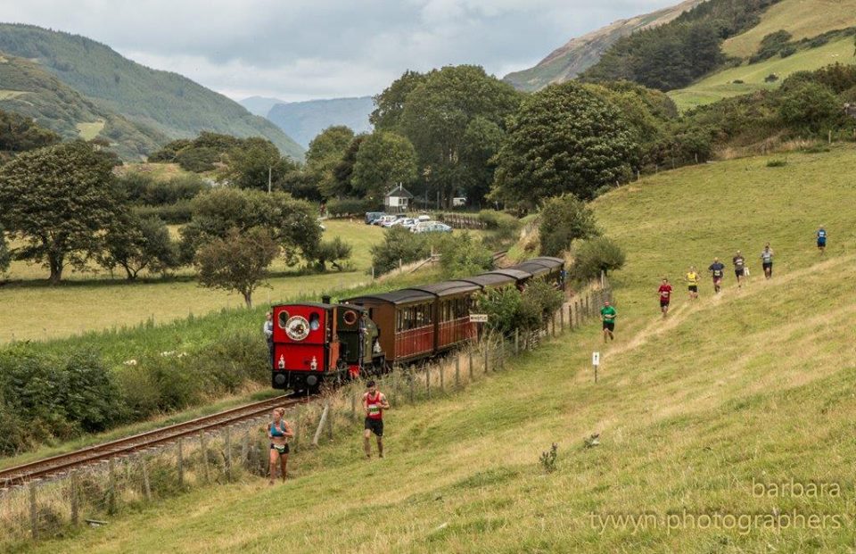
Ferney in the morning

The Ferney trail has three routes that you can run: 10 km, 17 km, and 35 km. I had entered the 17 km race, which involved 685 m of elevation: not the hardest race that I have ever entered but I was a little nervous about the effect that the heat was likely to have on me.

After jogging the couple of kilometers to the start line, I quivered with anticipation and nerves. I’ve never raced outside of the UK before and I had no idea what to expect. There were many people around me kitted out in very professional looking running gear. They spoke excitedly amongst themselves in French. I guessed that they were from Réunion, which is very mountainous and renowned for producing fantastic trail runners. My nerves heightened.

After the usual chaos of fighting my way past the initial crowd of runners, I found my running rhythm quickly and enjoyed flying along the dirt tracks in between sugarcane fields. As I started to climb the first hill I was surprised to see that I was passing a lot of people: I usually overtake people on the downhill and get overtaken on the uphill. As I continued to climb and passed more people it struck me that one of two things (or a combination of both) must have occurred – either my weekend runs up the hills in the Black River Gorges National Park had really paid off or the runners here were not as comfortable with hills as those back home. Whatever the case, I was delighted.

Up dirt tracks on exposed hills, along single tracks through the forests, and down steep and narrow paths thick with mud: this really was a fantastic trail. The views from the hills were staggering. One particularly beautiful scene was the first time that the Indian Ocean came into view: turquoise blue bay perfectly calm and protected by the outer reef that can be identified by a ring of frothy white water. I kept my eye out for the Mauritius Kestrel (Falco punctatus) but sadly they evaded me (and not for the first time since I moved to Mauritius a month ago). In many places the trails were so thick with red, iron-infused, mud that I had to stop to claw at the lugs from my trail shoes in attempt to gain more purchase and reduce the number of tumbles. Once when doing this I saw a tiny toad – the African common toad (Amietophrynus gutturalis).

LionMountain.2

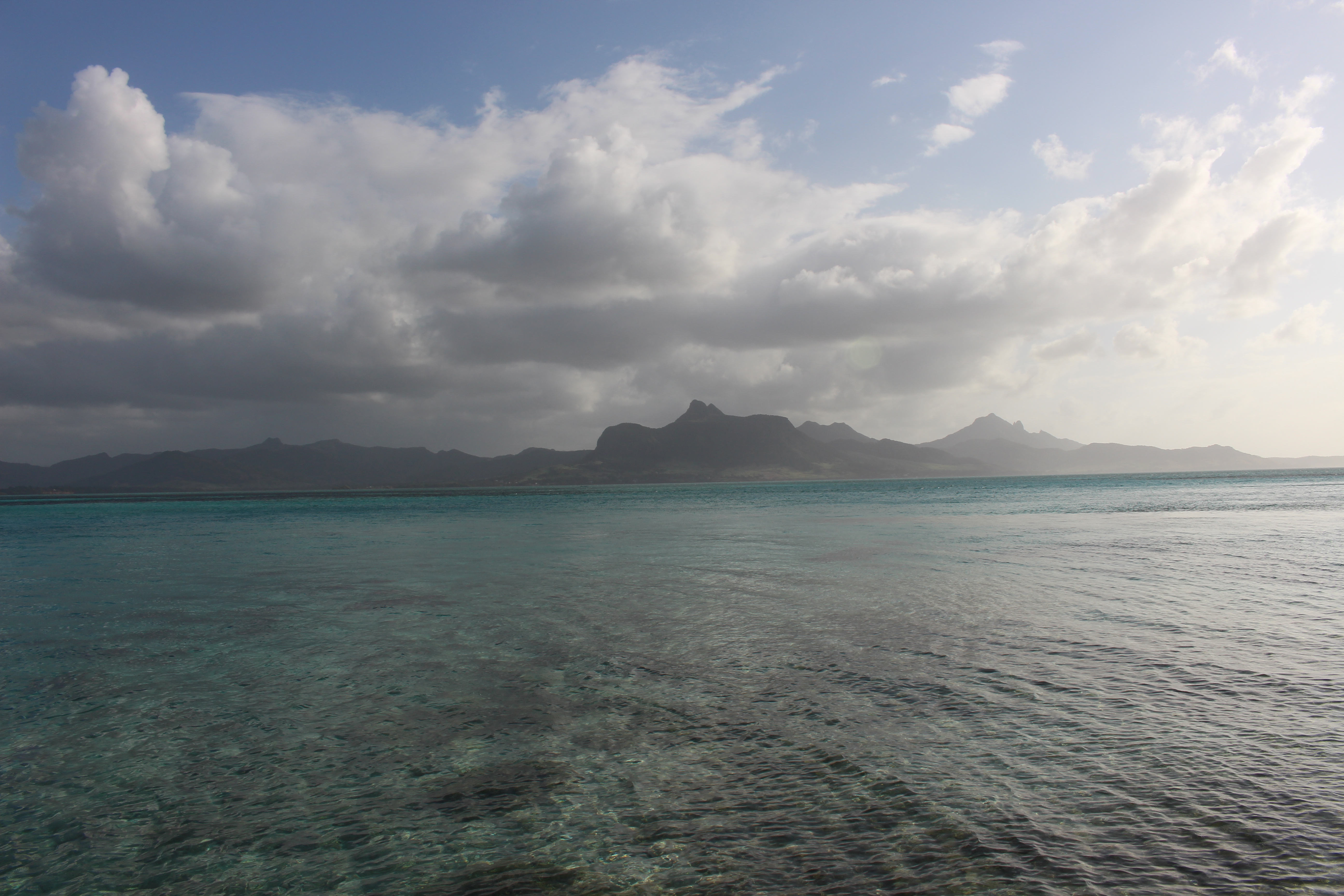
View of Lion Mountain – a section of the Ferney trail. Photo taken from Ile aux Aigrettes.

I was second lady up until the ‘5 km to go sign’. At this point a woman, who had been very close behind me for some time, had something extra left and pushed ahead. This didn’t bother me too much though because I was confident that if there was a last hill then I could catch her again. Unfortunately, the hill came too late and I couldn’t close the gap that she had created between us. I finished third with a massive smile and plenty of mud on my face.


Race the Train

If you look all over the world trying to find the perfect example of a train that will always leave on time, look no further than Tywyn, on the west coast of Wales. At exactly 14:05 on the third Saturday of August, it sets off inland, up into the Snowdonia National Park, packed as usual with people out to enjoy the countryside; many are young families. Cadair Idris looms above it. But few trains herald the departure of hundreds of runners (over 700 this year), eager to race the train up and down the valley, desperate to be back in Tywyn before it blows the finishing whistle.

We are gathered on the bridge next to the station; over to the right by the registration tent, music is playing and inflatable bouncy castles and slides stand silent. A marshal wearing a high-viz gilet straddles the bridge wall, one leg dangling towards the railway line, watching the train. There is a signal from the driver, a loud horn and cloud of steam and we are off, runners and the train alike. The course is 14 miles with around 280m of ascent, mostly on trails through slippery fields and clinging to hillsides. The train gets to stop at the stations; we don’t stop, we can’t afford to. For 31 years now this race has been going on, and each year between 10-15% of the runners manage to beat the train, which takes 1h48mins to complete the round trip.

I have to admit that the first 5 miles were tough. I had warmed up as usual but the fell race I had run the previous evening had taken its toll and my right leg was threatening to give up. But despite all the misery of those first few miles there are things that no runner should stand – these are, being beaten by anyone wearing a triathlon top, being beaten by anyone wearing a ‘tough mudder’ top, or being beaten by anyone with a stupid running slogan. I saw three people wearing running club tops whose slogan was ‘go hard or go home’. This so appalled me as being against the spirit of running as something enjoyable that I decided I had to beat all of them. Luckily I passed them early and never saw them again. The tough mudder guy, despite taking nearly all his clothes off by half-way, began to fade soon after passing me at breathtaking speed for a 14 mile race. He faded rapidly soon after. I’m not sure what happened to the triathlete.

Through the fields that formed the course on the way up the valley, I tried to enjoy the stunning scenery of southern Snowdonia, the flatness of the valley contrasting sharply with the steep hillsides and hanging woodlands surrounding it.There were regular drinks stops and hundreds of supporters on the sides of the track when we crossed near a road. Infrequently I would hear the steam-powered whistle of the dreaded train, but in my confusion I couldn’t work out if it was ahead or behind. The fields were thick with grass and slippery, and their slight angle made it hard on the ankles. There were some deep footprints in large fresh cow-pats.

After 5 miles I began to relax into a good pace and was enjoying the scenery, and after half-way I was feeling in good spirits, passing the 7 mile mark as we turned, went under a railway bridge and were on the return leg! Immediately after the railway bridge was a short steep hill, which most of us took at a walk. This was followed by a spectacular section along gently undulating hillside path, just wide enough for one person, but not wide enough to pass without leaping up into some gorse bushes. I was quite content to keep to the pace of the guy in front.

The next section apparently passed next to Dolgoch Falls. I can’t verify this as I heard but didn’t see a waterfall. There was definitely a river, which we crossed by bridge, and a lot of bog, which we ran through and in which I nearly lost a shoe and very nearly speared my hand on a nail as I slipped and grabbed a wooden post. Bog over we were sharply downhill, down which I threw myself, and along with several other tall runners dodged low branches for a few hundred metres. I was beginning to wonder where we were when we rejoined the outwards route and were running back into Tywyn. The last few fields had some very friendly marshals which certainly made the experience better despite there being one last steep uphill and some joint-pounding road sections left.

The crowd at the finish was incredible, cheering everyone. A commentator was seamlessly trying to encourage all the runners by name. He announced a few minutes after I finished that current finishers were still beating the train. I was relieved. My legs were now solid. Stretching was not fun. The atmosphere was brilliant though, and I have rarely seen an event so well put on as this one, for its size. Facilities were excellent and there were events for all ages, plus several other variants of ‘race the train’, including 10k, 5 mile and 3 mile races. There was even a goody bag with a t-shirt and snacks. The main race forms the final event in the Welsh Trail Running Championships, which explains the lightning fast times of the winners. But of course, for most of us, for the hundreds of runners and the equal hundreds of supporters and marshals, it’s not about winning, it’s about beating the train.

10377536_687489257966515_2977458193054863478_n

The Berwyns

A recent article on grough about the Berwyns was the first I had heard of this range of hills in central North-East Wales. The article was about a ‘missing’ Berwyn, absent on OS maps but which turned out to be the highest hill of the range. Intrigued about a hill range so unknown that the highest hill had been missed off, I went there for a run.
 
The Berwyns are quite high, peaking at 832m and with three peaks over 800m. They lie just outside the boundary of the Snowdonia National Park, which may explain their relative obscurity. I am sure they have their devotees and are treasured by the locals, but it says something about me, when I think I know the hills of Britain quite well, that I had never heard the name before. 
 
I drove along the small road leading into Cwm Maen Gwynedd looking up and around at the complete darkness and the spitting rain. The darkness itself was good evidence that there were hills there, and as the rain was meant to clear by morning, I pulled off the road somewhere below Rhos and went to sleep in the back of the van. 
 
The morning was bright and sunny, with a few clouds moving quite fast above. The high point of the main ridge, with the ‘missing’ hill Craig Berwyn visible as a jutting rocky peak surrounded by ridgeline and dropping fellside. I set off up one of the long arms of hills leading to this main ridge, running to the start of the steep slopes up Rhos, walking fast up the steepest section, and then breaking back into a run once on the undulating ridge, above 600m and approaching the summit of Rhos. The ground was mostly pathless apart from a few sheep tracks and the vegetation was thick heather with a diverse range of other plants. Apart from some boggy ground above a plantation it was dry but soft.
 
I was soon treated to a panorama of the main Berwyn ridge ahead as the sun came out, though clouds over to the North-West over Snowdonia promised some rain. My run continued over Mynydd Tarw and up to Tomle (742m), hills which provided perfect ascents for training, not too steep to have to walk but long enough to practice some pacing. Rain briefly came and went.
 
From the col before the main ridge I branched off on a track to run up to the summit of Cadair Bronwen, whose substantial summit cairn provided some shelter from the wind that was beginning to pick up. The views were extensive as I turned back around and ran south, now on the main ridge. This section does have recognisable path along it, and even some decking to reduce erosion, by a sign that alerts people to the SSSI status of the northern slopes.
 
Once on the approach to Cadair Berwyn, the ridge smoothes out and the path clings to the brilliantly steep southern slope, which drops back down to a young plantation a few hundred metres below. There is a trig point marking the summit of Cadair Berwyn (827m) and then a circular shelter before the obvious and much higher missing summit, where the rocks break through the soil. The wind had become prohibitive by this point, and somewhere to the West, Arenig Fawr was obscured. I ran along to the end of the high ridge, Moel Sych, and then followed the path down to another arm of hills reaching back into my original valley. 
 
The route over this spongy spur, which is only distinguished by the name ‘Godor’ for the end point, was slow going. Lots of high leg lifting was required and I was sometimes reduced to a walk in deep vegetation. There was periodically an old quad bike track evident on the summit, but the going only got fast again when I reached the top of Godor and began the descent back down to the valley tracks, passing bemused sheep huddling together from the wind.
 
I saw two other people that day, a Sunday in August with moderately good weather, who were both heading from Moel Sych towards Cadair Berwyn. The two hilly arms I had run up and down were without people or paths, and just went to show that the route we choose to get to the high peaks can be just as exciting as gaining the summits themselves. I am pleased to say I now know about the Berwyns, and from what I could see from the top, there are plenty of other valleys and hillsides to explore. There are also a few well defined trails, for those who don’t want the slowing down effect of uncropped vegetation, but I would certainly suggest giving it a go, just to get a true sense of this exceptional area. The route was around 24km with over 1000m of ascent.